
Loads of content
You can access all the exclusive
Hobonichi Globe content free of charge.
It is organized into 11 categories,
from educational topics to fun features
children can enjoy with their parents.
You'll have a blast exploring all our planet has to offer!
* The available AR content varies by language.
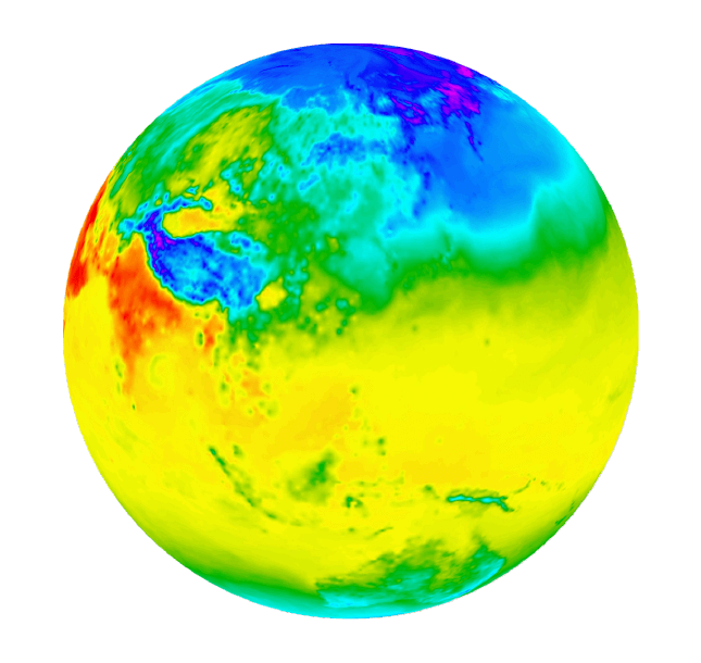
Earth Now
You can view the distribution of clouds, rain, and temperature around the world. Views are based on the latest data, updated every hour. You can also watch a video showing change over the past 24 hours. See how the Earth's appearance changes by the hour across borders and over land and sea.
*Data updates every 20 minutes. Displayed rain imagery extends from 60 degrees north latitude to 60 degrees south latitude.
Cloud and temperature imagery provided by Custom Weather.
〔Rain imagery provided by Global Satellite Mapping of Precipitation "GSMaP" (JAXA).
Earth This Week
Watch a video showing how clouds, precipitation, and temperature have changed around the world over the past week. Use the time slider or frame-by-frame playback to observe dynamic meteorological events worldwide, such as the formation and dissipation of tropical cyclones and temperature changes accompanying the passing of the seasons.
*Data updates every 35 minutes. Displayed rain imagery extends from 60 degrees north latitude to 60 degrees south latitude.
Cloud and temperature imagery provided by Custom Weather.
〔Rain imagery provided by Global Satellite Mapping of Precipitation "GSMaP" (JAXA).
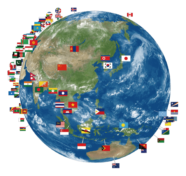
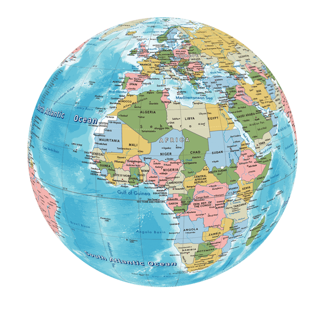
Countries of the World
Turn your Hobonichi Globe into a digital atlas covering every country in the world! A national flag appears over each country. Select one to read about it. Clearly arranged visuals present information to provide a snapshot of the country.
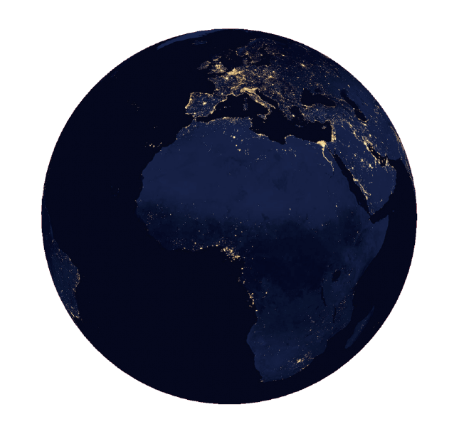
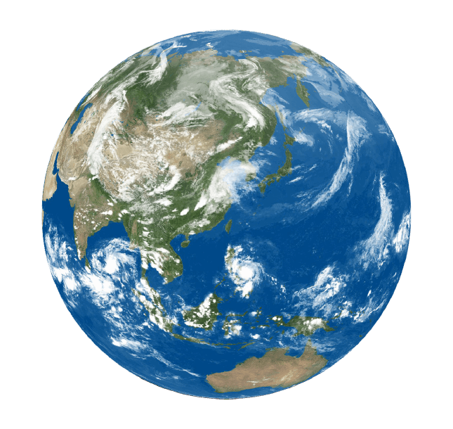
Earth at Night
See how the Earth looks from space at night! The nighttime lights on land come from the world's cities. Do you know what the lights on the oceans are? Fishing boats! Toggle day and night views and overlap city names and national borders to get a good look at our planet at night.
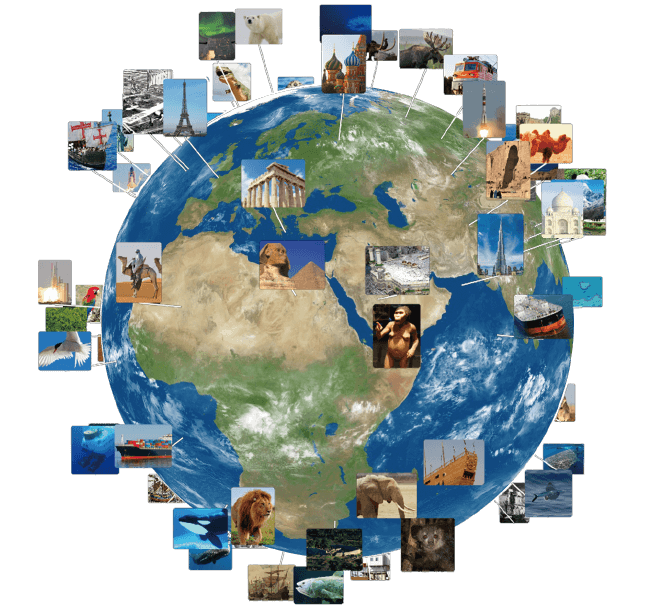
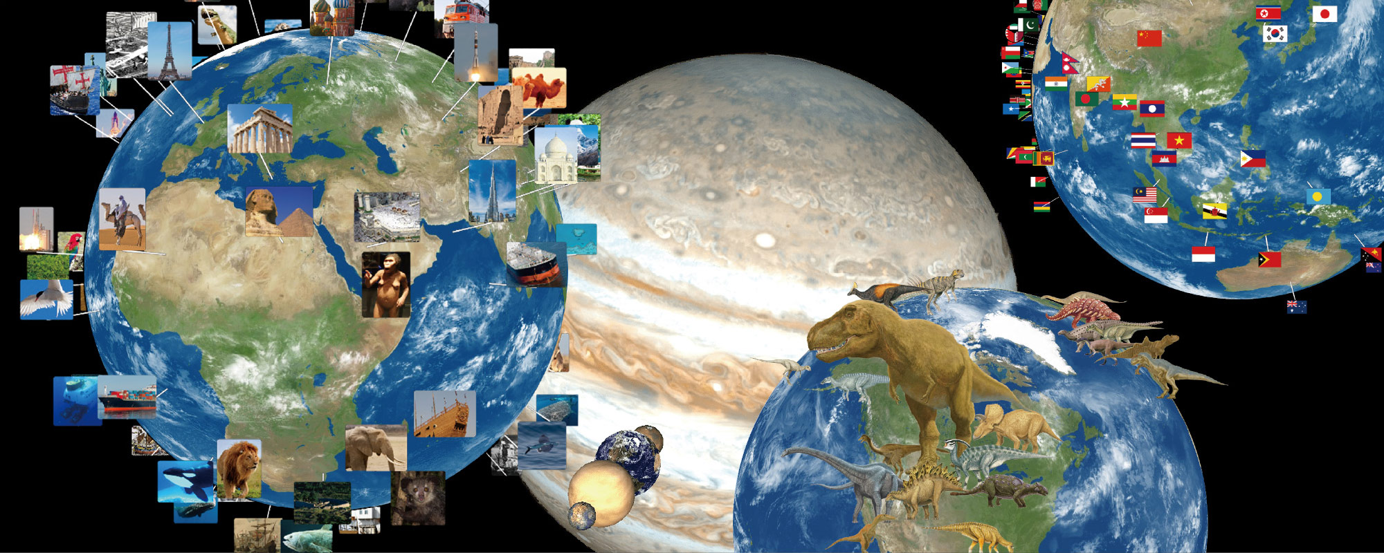
Picture Atlas
"Tap the photos that pop up from the Hobonichi Globe to bring up photos and information about interesting buildings, historical sites, animals, vehicles, and more from across the globe! Produced in cooperation with amana
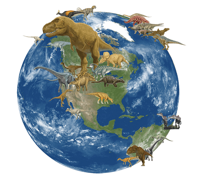
Poplardia Dinosaurs
See 50 dinosaurs from the "Poplardia Wonda Illustrated Encyclopedia of Dinosaurs" by Poplar Publishing standing on the Earth! You can look at the dinosaurs by the period when they lived: Triassic, Jurassic, and Cretaceous. Looking at the dinosaurs living in different parts of the world may help you to understand their evolution through time. Content courtesy of Poplar Publishing "Poplardia Wonda Illustrated Encyclopedia of Dinosaurs"
Classic Globe
Use a color-coded view of countries that clearly shows their shape and size. Another color-coded view shows differences in elevation from high to low. Lines of latitude and longitude present a globe we're all familiar with.
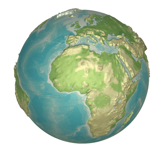
Pop-up Peaks
View the Earth's terrain with changes in elevation magnified by 100 times. You'll also find information about places like the Himalaya Mountains, a chain of peaks that reaches above 8,000 meters, and Antarctica, where the ice lies in sheets 3,000 meters thick. Joint research and development: Hidenori Watanave Laboratory, Tokyo Metropolitan University
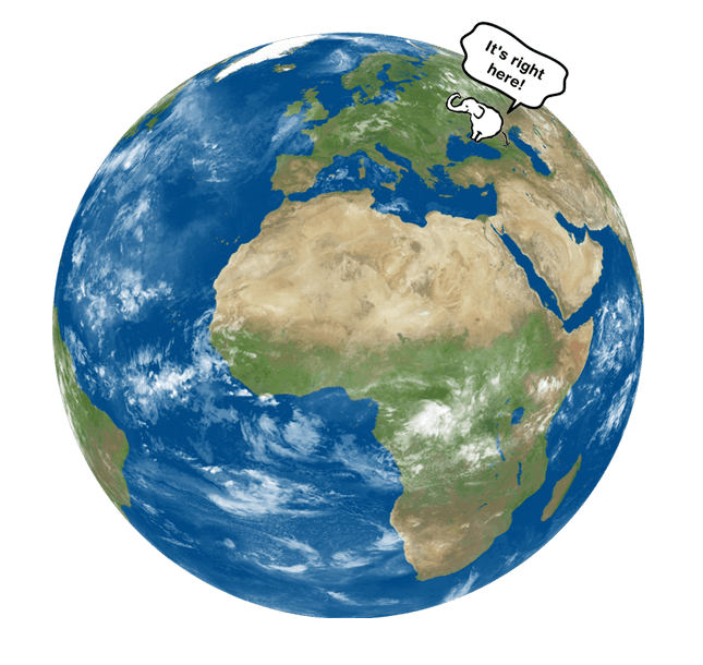
Elephinder
If you can't find a country or city, ask the Elephinder! Mind you, although being quite the know-it-all, this elephant is still in training to become a Master Elephinder, so the result you get might be a bit off the mark.
Massive Message
Launch a message into orbit around your EarthBall! It's a bonus feature to lighten the mood or get a laugh. Write whatever you want!
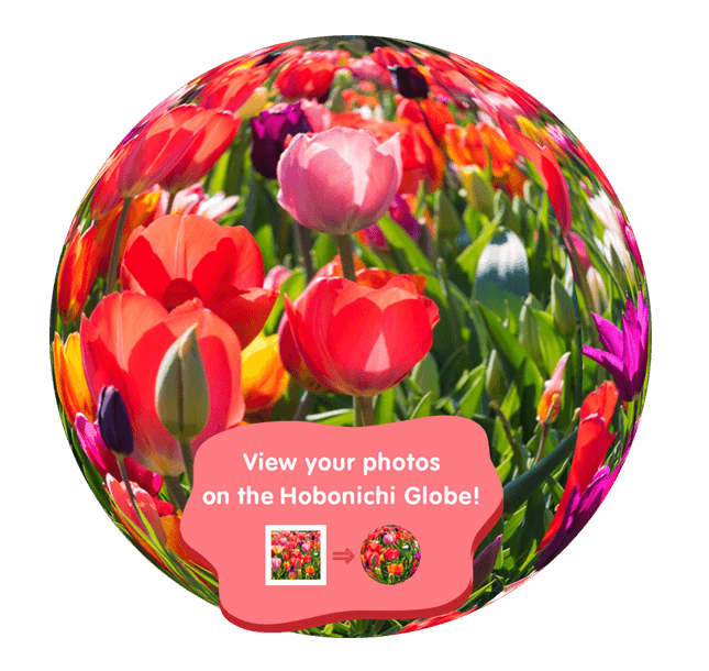
Photosphere
Did you know the Earth has a Photosphere? But it's not like the photosphere of a star that radiates light. This one launches your photos into the atmosphere!